 |
Google переводчик
|
|
Project «Recreating a virtual multi-level model of anthropogenic landscape Abrau Peninsula in ancient times according to archeology» supported by Russian Fond of Humanity Research, № 13-01-12017 (2013 - 2015 year).
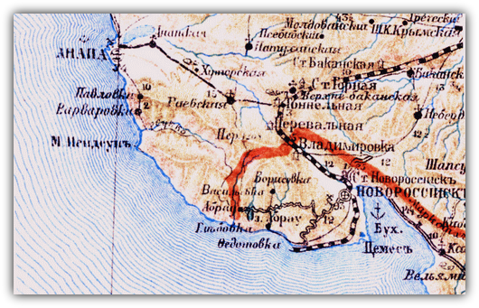
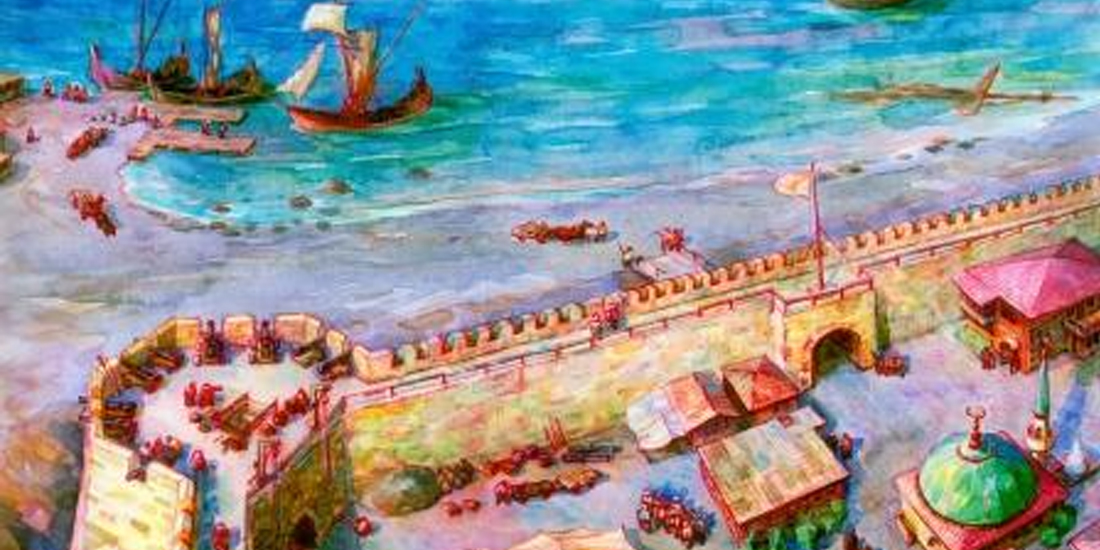
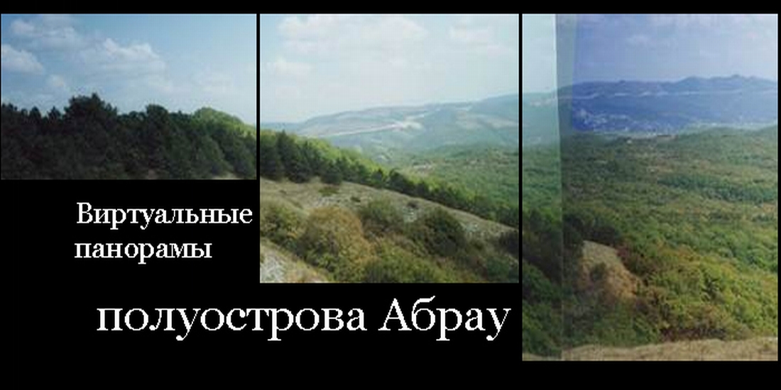
The aim of the project is to build a multi-level virtual reconstruction of man-made landscape of a region of the northern Black Sea region, which is part of the Bosporan state. The territory between the modern Anapa and Novorossiysk, in ancient times Gorgippia and Bata-haven in the literature called Peninsula Abrau.
These written records about the history of this region is extremely limited. However, due to many years of comprehensive study provides a great material to recreate not only a coherent picture of the ethno-political history of the region, but also due to the specifics of the archaeological sources, the evolution of man-made landscape of the region at a fairly large chronological gap. The most significant and varied the data on the ancient era, the period that the region in the Bosporus state.
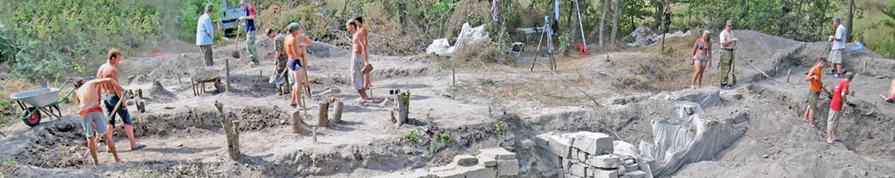
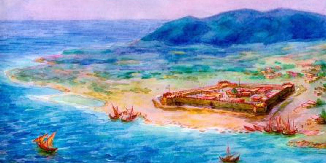
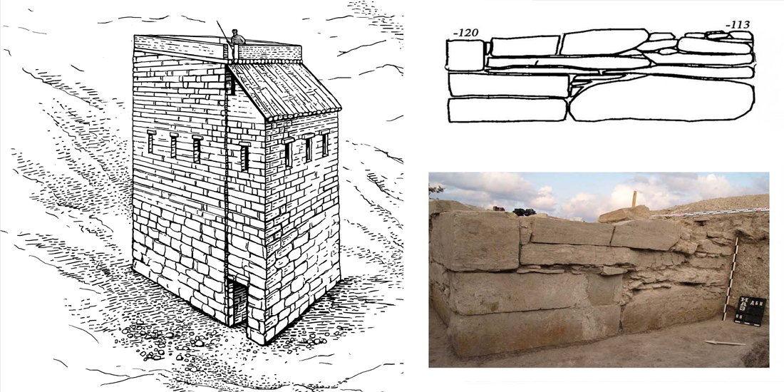
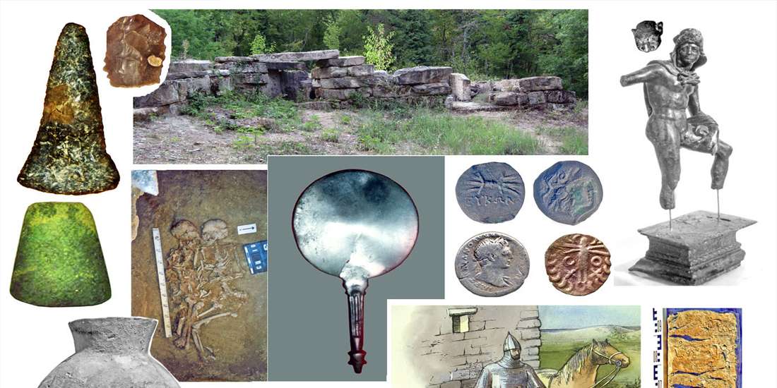
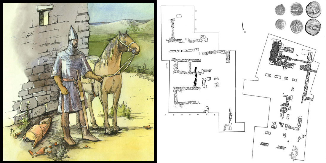
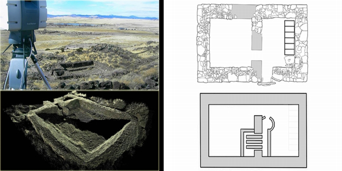
The main object of reconstruction is history Rajewski settlement, located in the vicinity of Novorossiisk. Geographical location, identified here buildings and complexes indicate its importance as an administrative center, overseen the mainland peninsula. Settlement, an area of ??about 15 hectares, is studied from the end of XIX century. Revealed two belts of fortifications to the citadel Early Roman era, a large tract of Hellenistic building with peristyle courtyard, the remains of the bastions of the Turkish fortress of time.
The available data allows you to make a detailed reconstruction of the spatial evolution of the fortification system of the center and other monumental structures. This reconstruction will be carried out with the help of modern three-dimensional modeling, and its main result is to create a virtual model of the environment in Unity, which allows the user to move freely in the space of three-dimensional model and will give a thorough account of the architectural appearance Rajewski settlement at all stages of its existence.
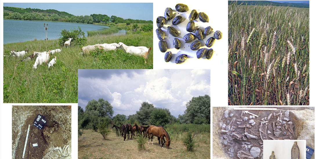
At the time of the Early Roman administrative center on the mound Raevsky controlled a vast network of checkpoints - fortified farmsteads, which were deployed small units of the regular army of the Bosporan state. The objective of this project is the reconstruction of the system of settlement on the peninsula Abra Early Roman period based on the data on the climatic conditions in this era.
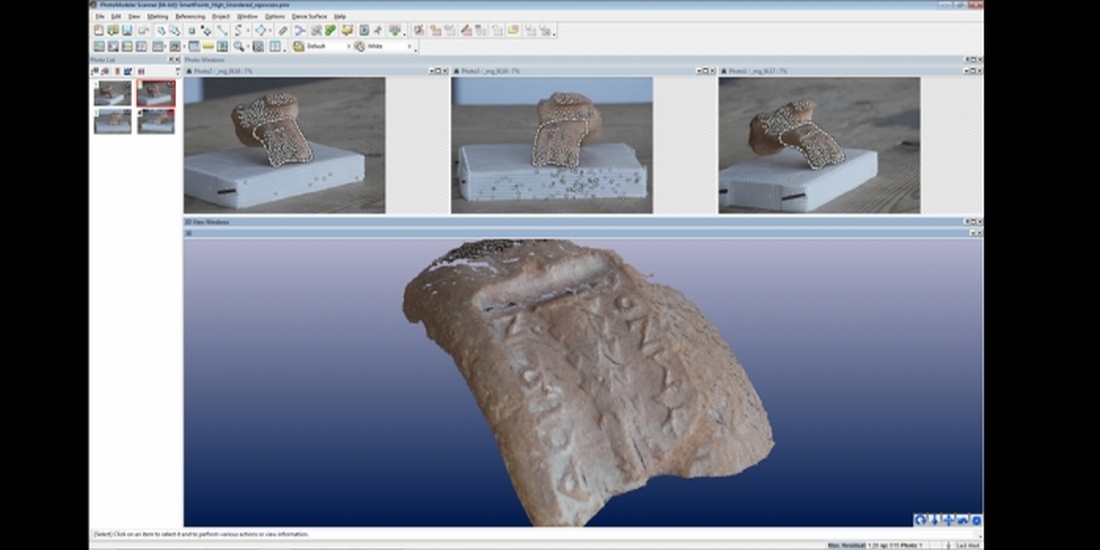
The models will be located on the site created for this "ABRAU ANTIQUA" on the Internet, making them available to the scientific community and a wide range of interested in ancient history. The resulting three-dimensional model will be used for archaeological spatial analyzes and as illustrations.
Result
Creating a virtual multi-level model among Unity man-made landscape of the peninsula Abrau. The most detailed section will be devoted to the Early Roman times: construction on Raevsky mound (two fortified zone defense with the citadel), the system of settlement in the region, including the network of checkpoints - fortified towers estates throughout the peninsula, the ancient buildings Gorgippia. A special place in the software product is Raevsky mound. In relation to it will create sections on the Hellenistic (monumental buildings in the north-west and residential development in other parts of the settlement, construction of the necropolis to the east of the settlement), the Early Roman (two zone defense, the citadel, buildings to the south of the citadel) periods are also planned reconstruct the horizon of the Middle Ages (the Turkish fortress Nogai-Kale with bastions, Circassian settlement with burial mounds and earth Muslim necropolis).
